Introductory GIS mapping
Learning outcomes
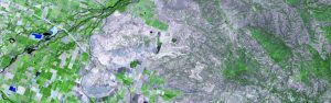
In this theme students will learn about what a GIS is, how to get started with the software, how objects in the real world can be represented on a map, how locations are recorded using coordinates, and how a two-dimensional map can be made from a three-dimensional Earth. In the theme project, students will create their own GIS data by tracing geographic features from a satellite image for a location and theme of their choice. This theme will provide a strong foundation in mapping and GIS that will give students the understanding they need to start working with GIS, and to continue to the other two themes in this course.
Course Content
- What is a GIS?
- Introduction to QGIS
- Vector and raster data (Mapping the real world)
- Coordinate Systems (Mapping Locations)
- Map Projections (Flattening the Earth)
- Project : Creating Your Own Data
Course Delivery
The course is presented through lectures in videos followed by brief quizzes. Brief instructions will be provided to guide students through the practical hands-on sessions.
Assessments
The course is assessed through exercises and project reports that must be submitted on-line.
Intended audience : Anybody who works with spatial data.
Instructors : Prof Fethi Ahmed and his team
Data acquisition and map design

Learning outcomes
In this theme, students will learn how to find GIS data for their own projects, and how to create a well-designed map that effectively communicates their message. The first section focuses on the basic building blocks of GIS data, so that students know what types of GIS files exist, and the implications of choosing one type over another. Students will know how to evaluate a data set (through metadata) before they decide to use it, as well as preparing data by merging and clipping files as needed. Students will learn how to take non-GIS data, such as a list of addresses, and convert it into “mappable” data using geocoding. Finally, students will learn about how to take data that they have found and design a map using cartographic principles. In the theme project, students will find their own data and create their own quantitative map.
Course Content
- GIS File Types, Data Models, and Topology
- Finding data and preparing it for your project
- Geocoding addresses and postal codes
- Map Design Principles
- Mapping Quantitative Data
- Quantitative Map Types
- Project: Getting Data and Making Your Own Map
Course Delivery
The course is presented through lectures in videos followed by brief quizzes. Brief instructions will be provided to guide students through the practical hands-on sessions.
Assessments
The course is assessed through exercises and project reports that must be submitted on-line.
Intended audience : Anybody who works with spatial data.
Instructors : Prof Fethi Ahmed and his team
Spatial analysis
Learning outcomes
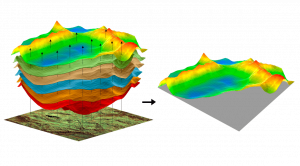
In this theme, students will learn how to analyse map data using different data types and methods to answer geographic questions. First, they will learn how to filter a data set using different types of queries to find just the data they need to answer a particular question. Then, simple yet powerful analysis methods that use vector data to find spatial relationships within and between data sets will be covered. Students will also learn about how to use model, a simple but powerful tool for building analysis flowcharts. Students will then learn how to find, understand, and use remotely sensed data such as satellite imagery, as a rich source of GIS data. Students will then learn how to analyse raster data. Finally, students will complete their own projects where they get to try out the new skills and tools they have learned about in this theme.
Each student will need a Windows computer with QGIS software installed.
Course Content
- Filtering Data Using Queries
- Vector analysis
- Remote sensing as a GIS data source
- Raster analysis
- Project: Spatial Analysis
Course Delivery
The course is presented through lectures in videos followed by brief quizzes. Brief instructions will be provided to guide students through the practical hands-on sessions.
Assessments
The course is assessed through exercises and project reports that must be submitted on-line.
Intended audience : Anybody who works with spatial data.
Instructors : Prof Fethi Ahmed and his team